Geolocate

Maghaway topographic map

Click on the map to display elevation.

About this map

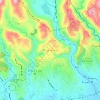
Name: Maghaway topographic map, elevation, terrain.

Location: Maghaway, Talisay, Cebu, Central Visayas, 6045, Philippines (10.25824 123.79617 10.29824 123.83617)

Average elevation: 122 m

Minimum elevation: 7 m

Maximum elevation: 333 m

Other topographic maps

Click on a map to view its topography, its elevation and its terrain.

Mananga River

Philippines > Cebu > Talisay

Average elevation: 17 m

Gear up for your next adventure:

🥾Trekking Boots - Durable boots for long-distance trekking
🥾Mountain Trail Shoes - High-traction shoes for mountain trails
🥾Light Trekking Boots - Supportive boots for multi-day treks
🥾Hiking Shorts - Breathable shorts suitable for summer hikes
🧢Hiking Sun Hat - Wide-brimmed protection for exposed mountain ridges

As an Amazon Associate, this site earns from qualifying purchases at no extra cost to you.