
Atakunmosa East topographic map
Interactive map
Click on the map to display elevation.
About this map
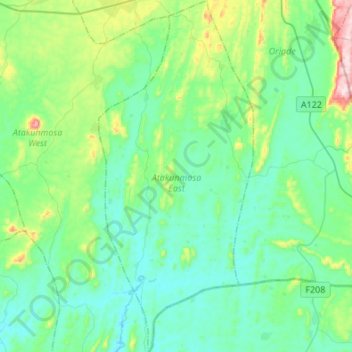
Name: Atakunmosa East topographic map, elevation, terrain.
Location: Atakunmosa East, Osun State, Nigeria (7.32310 4.72598 7.59154 4.84530)
Average elevation: 313 m
Minimum elevation: 215 m
Maximum elevation: 716 m
Other topographic maps
Click on a map to view its topography, its elevation and its terrain.
Ifewara
Nigeria > Osun State > Atakunmosa West
Ifewara, Atakunmosa West, Osun State, Nigeria
Average elevation: 338 m
Ilesa
Nigeria > Osun State > Ilesha West
Ilesa, Ilesha West, Osun State, Nigeria
Average elevation: 354 m