Geolocate

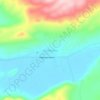
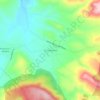
Cuitzeo topographic map

Click on the map to display elevation.

About this map

Name: Cuitzeo topographic map, elevation, terrain.

Location: Cuitzeo, Michoacán, Mexico (19.87635 -101.21080 20.09783 -101.01867)

Average elevation: 1,890 m

Minimum elevation: 1,828 m

Maximum elevation: 2,485 m

Other topographic maps

Click on a map to view its topography, its elevation and its terrain.
Zacapu

Mexico > Michoacán > Zacapu

Average elevation: 2,262 m

Villa Morelos

Mexico > Michoacán > Morelos > Villa Morelos

Average elevation: 2,352 m

La Yerbabuena

Mexico > Michoacán > Tlazazalca

Average elevation: 1,911 m

Jesús del Monte

Mexico > Michoacán > Morelia

Average elevation: 2,136 m

Chaparaco

Mexico > Michoacán > Zamora

Average elevation: 1,624 m

Zurumbeneo

Mexico > Michoacán > Zurumbeneo

Average elevation: 2,029 m

Ihuatzio

Mexico > Michoacán > Tzintzuntzan

Ihuatzio is located on the southeast of the Lake Pátzcuaro, about 8 kilometers southwest of the town center of Tzintzuntzan. Its average elevation is 2,052 meters above the sea level.

Average elevation: 2,052 m
Las Cieneguitas

Mexico > Michoacán > Tanhuato

Average elevation: 1,567 m

Gear up for your next adventure:

🥾Waterproof Hiking Boots - Boots keeping your feet dry in wet conditions
🧊Insulated Water Bottle - Keeps drinks cold in summer and prevents freezing in winter
🥾Trekking Boots - Durable boots for long-distance trekking
🔦LED Headlamp - Hands-free lighting for early morning starts or late finishes
⛺Camping Groundsheet - Protect your tent from moisture and dirt

As an Amazon Associate, this site earns from qualifying purchases at no extra cost to you.