

Healing Springs topographic map
Click on the map to display elevation.
About this map

Name: Healing Springs topographic map, elevation, terrain.
Location: Healing Springs, Benton County, Arkansas, United States (36.23480 -94.29826 36.27480 -94.25826)
Average elevation: 365 m
Minimum elevation: 329 m
Maximum elevation: 397 m
Other topographic maps
Click on a map to view its topography, its elevation and its terrain.


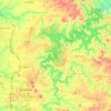
Beaver Lake
United States > Arkansas > Benton County > Goshen
Beaver Dam was authorized by the Flood Control Act of 1944 and other following acts. The United States Army Corps of Engineers constructed Beaver Dam during the years 1960-1966, impounding a major part of the White River and creating Beaver Lake and flooding much of the valley including the remains of the…
Average elevation: 392 m

Siloam Springs Lake
United States > Arkansas > Benton County > Siloam Springs
Average elevation: 341 m
Benton Country Fair Grounds
United States > Arkansas > Benton County > Bentonville
Average elevation: 384 m