

Beaver Lake topographic map
Click on the map to display elevation.
Beaver Lake
Beaver Dam was authorized by the Flood Control Act of 1944 and other following acts. The United States Army Corps of Engineers constructed Beaver Dam during the years 1960-1966, impounding a major part of the White River and creating Beaver Lake and flooding much of the valley including the remains of the historic resort town Monte Ne. The dam is located 9 miles (14 km) northwest of Eureka Springs, Arkansas. Construction of the powerhouse and switch yard began in 1963. Power generation began in May 1965 and continues today. The initial cost of the project was $60 million. The lake is approximately 50 miles (80 km) in length and covers approximately 31,700 acres (128 km2), with about 483 miles (777 km) of shoreline and an elevation of 1,120 feet (341 m). This is also the first dam in the tailwater chain to provide cold water fishery along the White River.
About this map
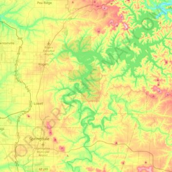
Name: Beaver Lake topographic map, elevation, terrain.
Location: Beaver Lake, Goshen, Benton County, Arkansas, United States (36.08999 -94.08352 36.45708 -93.80255)
Average elevation: 392 m
Minimum elevation: 284 m
Maximum elevation: 551 m