Geolocate

Garfield topographic map

Click on the map to display elevation.

About this map

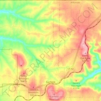
Name: Garfield topographic map, elevation, terrain.

Location: Garfield, Benton County, Arkansas, 72732, United States (36.43656 -94.01112 36.49888 -93.94922)

Average elevation: 453 m

Minimum elevation: 366 m

Maximum elevation: 524 m

Gear up for your next adventure:

💧Hydration Bladder - Hands-free hydration solution for long treks
🔦LED Flashlight - Powerful and long-lasting flashlight for camping and emergencies
Bushcraft Tarp - Versatile emergency shelter or gear protection
🧶550 Survival Paracord - Versatile utility cord for emergency repairs and rigging
🧢Sun Hat - Wide-brim hat for sun protection

As an Amazon Associate, this site earns from qualifying purchases at no extra cost to you.