Geolocate

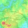
Spring Valley topographic map

Click on the map to display elevation.

About this map

Name: Spring Valley topographic map, elevation, terrain.

Location: Spring Valley, Durham, Durham County, North Carolina, United States (36.03660 -78.98373 36.04562 -78.97331)

Average elevation: 145 m

Minimum elevation: 112 m

Maximum elevation: 168 m

Other topographic maps

Click on a map to view its topography, its elevation and its terrain.

Hayes

United States > North Carolina > Durham County > Durham

Average elevation: 115 m

Weaver

United States > North Carolina > Durham County > Durham

Average elevation: 102 m

Few

United States > North Carolina > Durham County > Durham

Average elevation: 102 m

Gear up for your next adventure:

🛶Kayak Accessories - Essential gear for safe and fun kayaking adventures
🕯️Camping Lantern - Illuminates your entire campsite with high-efficiency LEDs
🧰Emergency Multi-Tool - Compact multi-tool for outdoor survival
🥤Collapsible Travel Cup - Saves space and weight in your mess kit
🏃Hydration Running Vest - Carry water and maps close to your body for speed

As an Amazon Associate, this site earns from qualifying purchases at no extra cost to you.