Geolocate

West Hills East topographic map

Click on the map to display elevation.

About this map
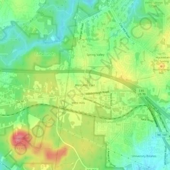
Name: West Hills East topographic map, elevation, terrain.

Location: West Hills East, Durham, Durham County, North Carolina, 27705, United States (36.01486 -79.00112 36.05486 -78.96112)

Average elevation: 146 m

Minimum elevation: 111 m

Maximum elevation: 193 m

Other topographic maps

Click on a map to view its topography, its elevation and its terrain.

Gear up for your next adventure:

🧥Thermal Fleece Jacket - Versatile insulation for changing mountain temperatures
🧥Packable Rain Jacket - Breathable waterproof layer for unpredictable weather
🧭GPS Outdoor Watch - Smart watch for navigation and fitness tracking in nature
🥾Mountaineering Boots - Supportive boots for climbing and high-altitude hiking
🗺️Topographic Maps - Detailed maps to explore trails, mountains, and wilderness areas

As an Amazon Associate, this site earns from qualifying purchases at no extra cost to you.