Geolocate

Mill Grove topographic map

Click on the map to display elevation.

About this map
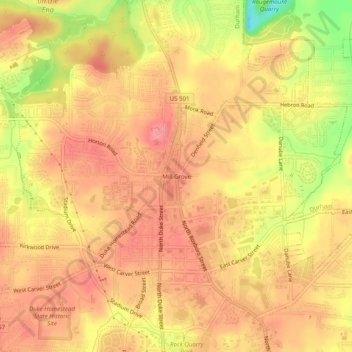
Name: Mill Grove topographic map, elevation, terrain.

Location: Mill Grove, Durham, Durham County, North Carolina, 27704, United States (36.03098 -78.92362 36.07098 -78.88362)

Average elevation: 111 m

Minimum elevation: 49 m

Maximum elevation: 138 m

Other topographic maps

Click on a map to view its topography, its elevation and its terrain.

Gear up for your next adventure:

⛺Lightweight Camping Tent - Portable shelter optimized for Canadian backcountry camping
🥾Hiking Shorts - Breathable shorts suitable for summer hikes
🧥Waterproof Pants - Keep dry during rainy hiking conditions
⛺Backpacking Tent - Lightweight tent for long-distance hiking trips
🧼Biodegradable Camp Soap - Environmentally friendly cleaning for gear and body

As an Amazon Associate, this site earns from qualifying purchases at no extra cost to you.