Geolocate

Mill Grove topographic map

Click on the map to display elevation.

About this map
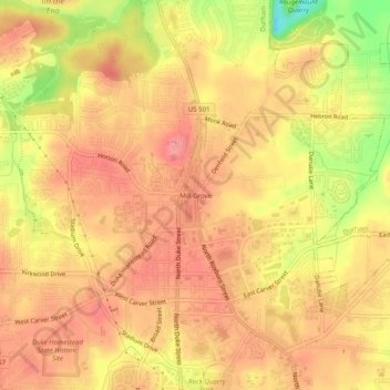
Name: Mill Grove topographic map, elevation, terrain.

Location: Mill Grove, Durham, Durham County, North Carolina, 27704, United States (36.03098 -78.92362 36.07098 -78.88362)

Average elevation: 111 m

Minimum elevation: 49 m

Maximum elevation: 138 m

Other topographic maps

Click on a map to view its topography, its elevation and its terrain.

Gear up for your next adventure:

🧴First Aid Kit - Essential first aid supplies for outdoor emergencies
🛶Waterproof Dry Bags - Keep electronics and clothes dry during river crossings
🔪Outdoor Multitool - Versatile tool for repairs and food prep in the wild
🥾Trekking Boots - Durable boots for long-distance trekking
🌡️Emergency Mylar Blankets - Compact thermal protection for unexpected nights outdoors

As an Amazon Associate, this site earns from qualifying purchases at no extra cost to you.