

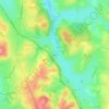
Gergy topographic map
Click on the map to display elevation.
Gergy
Gergy est située dans la plaine alluviale de la Saône. La géologie des sols est issue de trois formations sédimentaires : Le quaternaire ancien, le quaternaire récent (bord de Saône) et le pliocène (au nord). L'altitude varie de 172 à 208 mètres.
About this map

Name: Gergy topographic map, elevation, terrain.
Average elevation: 185 m
Minimum elevation: 171 m
Maximum elevation: 214 m
Other topographic maps
Click on a map to view its topography, its elevation and its terrain.

Commune
France > Bourgogne-Franche-Comté > Saône-et-Loire > Martigny-le-Comte
Average elevation: 353 m

Les Longs Bois
France > Bourgogne-Franche-Comté > Saône-et-Loire > Saint-Forgeot
Average elevation: 305 m

Les Rues
France > Bourgogne-Franche-Comté > Saône-et-Loire > Fleury-la-Montagne
Average elevation: 376 m

Le Rousset
France > Bourgogne-Franche-Comté > Saône-et-Loire > Le Rousset-Marizy
Average elevation: 403 m


Les Combes du Haut
France > Bourgogne-Franche-Comté > Saône-et-Loire > Montcenis
Average elevation: 409 m


La Piat
France > Bourgogne-Franche-Comté > Saône-et-Loire > Saint-Amour-Bellevue
Average elevation: 243 m

Balme de Rochebin
France > Bourgogne-Franche-Comté > Saône-et-Loire > Azé > Montchanin
Average elevation: 305 m

Les Rompas
France > Bourgogne-Franche-Comté > Saône-et-Loire > Saint-Romain-sous-Gourdon
Average elevation: 361 m

Le Colombier
France > Bourgogne-Franche-Comté > Saône-et-Loire > Navour-sur-Grosne
Average elevation: 347 m


Les Vernes
France > Bourgogne-Franche-Comté > Saône-et-Loire > Saint-Bonnet-en-Bresse
Average elevation: 190 m

Les Crozes
France > Bourgogne-Franche-Comté > Saône-et-Loire > Saint-Igny-de-Roche
Average elevation: 421 m


Frêne
France > Bourgogne-Franche-Comté > Saône-et-Loire > Lournand > Sous Lourdon
Average elevation: 352 m


Martoret
France > Bourgogne-Franche-Comté > Saône-et-Loire > Saint-Maurice-de-Satonnay
Average elevation: 228 m


Robin
France > Bourgogne-Franche-Comté > Saône-et-Loire > Saint-Martin-de-Lixy
Average elevation: 350 m


Les Brosses
France > Bourgogne-Franche-Comté > Saône-et-Loire > Davayé > Les Brosses
Average elevation: 277 m

Les Poncétys
France > Bourgogne-Franche-Comté > Saône-et-Loire > Davayé > Les Poncétys
Average elevation: 283 m


La Garde
France > Bourgogne-Franche-Comté > Saône-et-Loire > Navour-sur-Grosne
Average elevation: 349 m


Les Tréaux
France > Bourgogne-Franche-Comté > Saône-et-Loire > La Grande-Verrière
Average elevation: 422 m


Estours
France > Bourgogne-Franche-Comté > Saône-et-Loire > Crêches-sur-Saône
Average elevation: 186 m


La Ferdière du Bas
France > Bourgogne-Franche-Comté > Saône-et-Loire > Navour-sur-Grosne
Average elevation: 363 m


Château de Pierreclos
France > Bourgogne-Franche-Comté > Saône-et-Loire > Pierreclos
Average elevation: 335 m

La Brancionne
France > Bourgogne-Franche-Comté > Saône-et-Loire > Crêches-sur-Saône
Average elevation: 193 m

Les Trèches
France > Bourgogne-Franche-Comté > Saône-et-Loire > Saint-Yan > Les Trèches
Average elevation: 257 m


Brancion
France > Bourgogne-Franche-Comté > Saône-et-Loire > Martailly-lès-Brancion
Average elevation: 303 m


Les Agrots
France > Bourgogne-Franche-Comté > Saône-et-Loire > Fleury-la-Montagne
Average elevation: 379 m


Les Justices
France > Bourgogne-Franche-Comté > Saône-et-Loire > Saint-Julien-de-Jonzy
Average elevation: 418 m

Les Baudys
France > Bourgogne-Franche-Comté > Saône-et-Loire > Berzé-le-Châtel
Average elevation: 419 m

Le Reuil
France > Bourgogne-Franche-Comté > Saône-et-Loire > Mont-Saint-Vincent
Average elevation: 459 m


Les Branles
France > Bourgogne-Franche-Comté > Saône-et-Loire > Curtil-sous-Buffières
Average elevation: 377 m


Le Montsacc
France > Bourgogne-Franche-Comté > Saône-et-Loire > Saint-Christophe-en-Brionnais
Average elevation: 431 m


Le Potet
France > Bourgogne-Franche-Comté > Saône-et-Loire > Matour > Le Potet
Average elevation: 534 m


Grolier
France > Bourgogne-Franche-Comté > Saône-et-Loire > Pierreclos > Grolier
Average elevation: 361 m

Le Crot au Meunier
France > Bourgogne-Franche-Comté > Saône-et-Loire > La Grande-Verrière
Average elevation: 513 m


Arbain
France > Bourgogne-Franche-Comté > Saône-et-Loire > Savigny-sur-Seille
Average elevation: 191 m


La Gravière
France > Bourgogne-Franche-Comté > Saône-et-Loire > Verosvres > La Gravière
Average elevation: 379 m


Tunnel des Crottes
France > Bourgogne-Franche-Comté > Saône-et-Loire > La Clayette
Average elevation: 391 m


