Geolocate

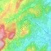
Jamproye topographic map

Click on the map to display elevation.

About this map

Name: Jamproye topographic map, elevation, terrain.

Location: Jamproye, Mercurey, Chalon-sur-Saône, Saône-et-Loire, Bourgogne-Franche-Comté, France métropolitaine, 71640, France (46.81572 4.71147 46.85572 4.75147)

Average elevation: 258 m

Minimum elevation: 198 m

Maximum elevation: 390 m

Other topographic maps

Click on a map to view its topography, its elevation and its terrain.
Gear up for your next adventure:

🧤Insulated Winter Gloves - Heavy-duty protection for sub-zero Canadian adventures
🩹Compact First Aid Kit - Pre-packed essentials for common trail injuries
🧼Biodegradable Camp Soap - Environmentally friendly cleaning for gear and body
🧢Hiking Hat - Sun-protective and breathable hats for long treks
🥾Mountain Trail Shoes - High-traction shoes for mountain trails

As an Amazon Associate, this site earns from qualifying purchases at no extra cost to you.