Geolocate

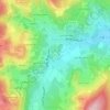
Les Enceints topographic map

Click on the map to display elevation.

About this map

Name: Les Enceints topographic map, elevation, terrain.

Location: Les Enceints, Pierreclos, Mâcon, Saône-et-Loire, Bourgogne-Franche-Comté, France métropolitaine, 71960, France (46.32276 4.65450 46.36276 4.69450)

Average elevation: 408 m

Minimum elevation: 241 m

Maximum elevation: 731 m

Other topographic maps

Click on a map to view its topography, its elevation and its terrain.
Gear up for your next adventure:

💧Hydration Pack - Hands-free hydration system for long hikes
🚲Bike Repair Kit - Essential tools for on-trail mechanical issues
🥾Mountain Hiking Boots - High-traction boots for rocky terrain
🥾Trekking Boots - Durable boots for long-distance trekking
🥾Lightweight Hiking Boots - Boots for comfort and mobility on long hikes

As an Amazon Associate, this site earns from qualifying purchases at no extra cost to you.