Geolocate

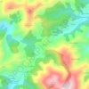
Gozón topographic map

Click on the map to display elevation.

About this map

Name: Gozón topographic map, elevation, terrain.

Location: Gozón, Asturias, Spain (43.55213 -5.94799 43.66653 -5.76521)

Average elevation: 35 m

Minimum elevation: -10 m

Maximum elevation: 168 m

Other topographic maps

Click on a map to view its topography, its elevation and its terrain.
El Ferrol

Spain > Asturias > Castropol

Average elevation: 39 m

Avín

Spain > Asturias > Onís > Benia de Onís

Average elevation: 393 m

Liares

Spain > Asturias > Ibias

Average elevation: 713 m

El Retornu

Spain > Asturias > Piloña

Average elevation: 592 m

Sotrondio

Spain > Asturias > Samartín del Rei Aurelio

Average elevation: 424 m

La Barganiza

Spain > Asturias > Siero

Average elevation: 199 m

Boriñes

Spain > Asturias > Piloña

Average elevation: 310 m

Mones

Spain > Asturias > Valdés

Average elevation: 473 m

Siecha

Spain > Asturias > Cangas del Narcea

Average elevation: 892 m

Gear up for your next adventure:

🕶️Polarized Sunglasses - Reduces glare from snow and water at high elevations
🧣Evaporative Cooling Towel - Beat the heat during intense summer climbs
🧰Emergency Multi-Tool - Compact multi-tool for outdoor survival
🧣Merino Neck Gaiter - Protects against wind, sun, and cold at high altitudes
🦯Trekking Poles - Reduced impact on joints for steep topographic climbs

As an Amazon Associate, this site earns from qualifying purchases at no extra cost to you.