
Bethesda topographic map
Click on the map to display elevation.
About this map
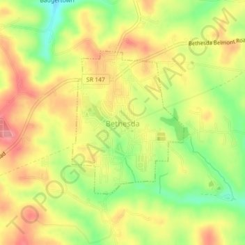
Name: Bethesda topographic map, elevation, terrain.
Location: Bethesda, Belmont County, Ohio, United States (40.00837 -81.07990 40.02417 -81.06376)
Average elevation: 376 m
Minimum elevation: 324 m
Maximum elevation: 417 m
Other topographic maps
Click on a map to view its topography, its elevation and its terrain.