Geolocate

Wolfhurst topographic map

Click on the map to display elevation.

About this map

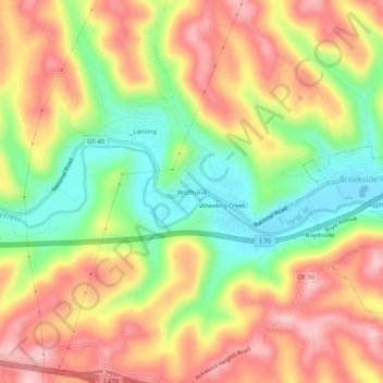
Name: Wolfhurst topographic map, elevation, terrain.

Location: Wolfhurst, Belmont County, Ohio, 43934, United States (40.04924 -80.80370 40.08924 -80.76370)

Average elevation: 296 m

Minimum elevation: 193 m

Maximum elevation: 389 m

Other topographic maps

Click on a map to view its topography, its elevation and its terrain.

Neffs

United States > Ohio > Belmont County > Neffs

Average elevation: 300 m

Morristown

United States > Ohio > Belmont County

Average elevation: 374 m

Flushing

United States > Ohio > Belmont County

Average elevation: 365 m

Holloway

United States > Ohio > Belmont County

Average elevation: 313 m

Brookside

United States > Ohio > Belmont County

Average elevation: 281 m

Bridgeport

United States > Ohio > Belmont County

Average elevation: 244 m

Bethesda

United States > Ohio > Belmont County

Average elevation: 376 m

Belmont

United States > Ohio > Belmont County

Average elevation: 361 m

Martins Ferry

United States > Ohio > Belmont County

Average elevation: 288 m

Piedmont Lake

United States > Ohio > Belmont County

Average elevation: 321 m

Yorkville

United States > Ohio > Belmont County

Average elevation: 256 m

Powhatan Point

United States > Ohio > Belmont County

Average elevation: 241 m

Shadyside

United States > Ohio > Belmont County

Average elevation: 245 m

Gear up for your next adventure:

🧥Softshell Hiking Jacket - The perfect balance of wind protection and breathability
💧Filtered Water Bottle - Safe drinking water on the go
🧤Thermal Hiking Gloves - Grip-enhanced gloves for cold-weather altitude trekking
📷Outdoor Action Camera - Capture high-elevation views and rugged adventures
🧦Hiking Liner Socks - Thin base layer to prevent friction and blisters

As an Amazon Associate, this site earns from qualifying purchases at no extra cost to you.