Geolocate

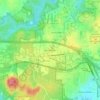
Croasdaile Farm topographic map

Click on the map to display elevation.

About this map

Name: Croasdaile Farm topographic map, elevation, terrain.

Location: Croasdaile Farm, Durham, Durham County, North Carolina, United States (36.03672 -78.95761 36.05688 -78.93540)

Average elevation: 137 m

Minimum elevation: 98 m

Maximum elevation: 180 m

Other topographic maps

Click on a map to view its topography, its elevation and its terrain.

Hayes

United States > North Carolina > Durham County > Durham

Average elevation: 115 m

Weaver

United States > North Carolina > Durham County > Durham

Average elevation: 102 m

Few

United States > North Carolina > Durham County > Durham

Average elevation: 102 m

Gear up for your next adventure:

👟Sport Hiking Sandals - Breathable footwear for water crossings and camp rest
🧦Crew Hiking Socks - Comfortable socks for long-distance hikes
⛺Camping Groundsheet - Protect your tent from moisture and dirt
🍽️Titanium Camping Spork - Ultralight and indestructible eating utensil
💡Compact LED Flashlight - Powerful and portable flashlight for outdoor use

As an Amazon Associate, this site earns from qualifying purchases at no extra cost to you.