Geolocate

Vansant topographic map

Click on the map to display elevation.

About this map

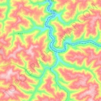
Name: Vansant topographic map, elevation, terrain.

Location: Vansant, Buchanan County, Virginia, 24656, United States (37.20706 -82.14725 37.25726 -82.04952)

Average elevation: 547 m

Minimum elevation: 322 m

Maximum elevation: 725 m

Other topographic maps

Click on a map to view its topography, its elevation and its terrain.

Whitewood

United States > Virginia > Buchanan County

Average elevation: 674 m

Rowe

United States > Virginia > Buchanan County

Average elevation: 654 m

Patterson

United States > Virginia > Buchanan County

Average elevation: 579 m

Oakwood

United States > Virginia > Buchanan County

Average elevation: 584 m

Mavisdale

United States > Virginia > Buchanan County

Average elevation: 578 m

Keen Mountain

United States > Virginia > Buchanan County

Average elevation: 682 m

Big Rock

United States > Virginia > Buchanan County

Average elevation: 423 m

Davenport

United States > Virginia > Buchanan County

Average elevation: 550 m

Height

United States > Virginia > Buchanan County

Average elevation: 725 m

Gear up for your next adventure:

🛏️Sleeping Bag - Warm and compact sleeping bags for outdoor camping
🧢Sun Protection Cap - Breathable cap to protect from sun exposure
🏃Hydration Running Vest - Carry water and maps close to your body for speed
🧥Waterproof Pants - Keep dry during rainy hiking conditions
🧰Multitool Knife - Compact and versatile tool for outdoor use

As an Amazon Associate, this site earns from qualifying purchases at no extra cost to you.