Geolocate

Whitewood topographic map

Click on the map to display elevation.

About this map

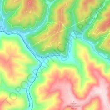
Name: Whitewood topographic map, elevation, terrain.

Location: Whitewood, Buchanan County, Virginia, 24657, United States (37.21567 -81.87706 37.25567 -81.83706)

Average elevation: 674 m

Minimum elevation: 494 m

Maximum elevation: 875 m

Other topographic maps

Click on a map to view its topography, its elevation and its terrain.

Vansant

United States > Virginia > Buchanan County

Average elevation: 547 m

Gear up for your next adventure:

🔥Emergency Fire Starter - Reliable ignition source for all weather conditions
🧰Survival Kit - Essential gear for emergencies in the wilderness
🧤Rechargeable Heated Gloves - Extreme warmth for Canadian winter expeditions
🥾Light Trekking Boots - Supportive boots for multi-day treks
🧴Insect Repellent - Protect yourself from bugs during outdoor adventures

As an Amazon Associate, this site earns from qualifying purchases at no extra cost to you.