

Kursk Oblast topographic map
Click on the map to display elevation.
Kursk Oblast
The oblast, with an average elevation is 177–225 meters (580–738 ft), occupies the southern slopes of the middle-Russian plateau. The surface is hilly and intersected by ravines. The central part of Kursk oblast is more elevated than the Seym Valley to the west. The Timsko-Shchigrinsky ridge contains the highest point in the oblast at 288 meters (945 ft) above the sea level. The low relief, gentle slopes, and mild winters make the area suitable for farming, and much of the forest has been cleared.
About this map
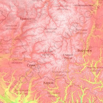
Name: Kursk Oblast topographic map, elevation, terrain.
Location: Kursk Oblast, Central Federal District, Russia (49.05685 33.88527 54.25685 39.08527)
Average elevation: 172 m
Minimum elevation: 53 m
Maximum elevation: 289 m
Other topographic maps
Click on a map to view its topography, its elevation and its terrain.
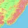
Primorsky Krai
Highlands dominate the territory of the krai. Most of the territory is mountainous, and almost 80% of it is forested. The average elevation is about 500 meters (1,640 ft). Sikhote-Alin is a mountainous formation, extending for the most part of the Krai. It consists of a number of parallel ranges: the…
Average elevation: 237 m

Lena River
Russia > Sakha Republic > Булунский наслег
Originating at an elevation of 1,640 meters (5,381 ft) at its source in the Baikal Mountains south of the Central Siberian Plateau, 7 kilometres (4 mi) west of Lake Baikal, the Lena flows northeast, being joined by the Kirenga River, Vitim River and Olyokma River. From Yakutsk it enters the Central Yakutian…
Average elevation: 20 m
Nizhnyaya Shilovka
Russia > Krasnodar Krai > Resort Town of Sochi (municipal formation)
Average elevation: 164 m
Ob River
The combined Ob-Irtysh system, the fourth-longest river system of Asia (after Yenisei, and China's Yangzi and Yellow rivers), is 5,410 kilometres (3,360 mi) long, and the area of its basin 2,990,000 square kilometres (1,150,000 sq mi). The river basin of the Ob consists mostly of steppe, taiga, swamps, tundra,…
Average elevation: 122 m
Lena River
Originating at an elevation of 1,640 meters (5,381 ft) at its source in the Baikal Mountains south of the Central Siberian Plateau, 7 kilometres (4 mi) west of Lake Baikal, the Lena flows northeast across the Lena-Angara Plateau, being joined by the Kirenga, Vitim and Olyokma. From Yakutsk it enters the…
Average elevation: 182 m
Krasnoyarsk
Russia > Krasnoyarsk Krai > Krasnoyarsk Urban Okrug
The river Yenisei flows from west to east through the city. Due to the Krasnoyarsk hydroelectric dam 32 km (20 mi) upstream, the Yenisei never freezes in winter and never exceeds +14 °C (57 °F) in summer through the city. Near the city center, its elevation is 136 m (446 ft) above sea level. There are…
Average elevation: 285 m

Sverdlovsk Oblast
The highest mountains all rise in the North Urals, Konzhakovsky Kamen at 1,569 metres (5,148 ft) and Denezhkin Kamen at 1,492 metres (4,895 ft). The Middle Urals is mostly hilly country with no discernible peaks; the mean elevation is closer to 300 to 500 metres (980 to 1,640 ft) above sea level. Principal…
Average elevation: 174 m

Tambov
However, the administrative and commercial functions of the city were not in line with the slow economic growth of Tambov. In terms of the number of townspeople, it lagged behind many provincial centers such as Oryol, Kursk and Voronezh. In the 1780s things began to change when poet and statesman Gavrila…
Average elevation: 153 m


Chelyabinsk
Russia > Chelyabinsk Oblast > Chelyabinsk
Shortly after dawn on February 15, 2013, a superbolide meteor descended at over 55,000 kilometers per hour (34,000 mph) over the Ural Mountains, exploding at an altitude of 25–30 kilometers (16–19 mi).
Average elevation: 230 m
Kyzyl
Russia > Tuva Republic > Kyzyl City
They began to lay a new city in the village of Vilany, in Tuvan – Khem-Beldyr, which means "confluence of rivers". Technological engineer K.V. Goguntsov and topographer M. Ya. Kryuchkov arrived here in February 1914. Kryuchkov drew a general plan of the city of Belotsarsk (fund 123, opis, 2, delo 21), which…
Average elevation: 799 m
Omsk Oblast
The highest elevation in the Omsk region - about 150 m (490 ft) Upland village, the lowest elevation is the water's edge on the Irtysh - 41 metres (135 ft), near the village of Little Beach.
Average elevation: 110 m