

Ardèche topographic maps
Click on a map to view its topography, its elevation and its terrain.














Saint-Laurent-les-Bains
France > Auvergne-Rhône-Alpes > Ardèche > Saint-Laurent-les-Bains-Laval-d'Aurelle
Average elevation: 1,041 m


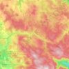


Privas
France > Auvergne-Rhône-Alpes > Ardèche
During the siege of 1629, the town of Privas was well defended by walls and ditches. Privas also has gorges to its south, east and north that provide a natural defence. Given this topography, the Huguenots in the town did not believe that a strong attack from the east was possible. Nevertheless, on 22 May, the…
Average elevation: 367 m






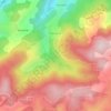


Hameau de Romanieux
France > Auvergne-Rhône-Alpes > Ardèche > Saint-Alban-d'Ay
Average elevation: 710 m


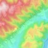


About this place
Rompon • Le Béage • Saint-Basile • Malarce-sur-la-Thines • Lagorce • Boffres • Aizac • Les Salelles • Lemps • Lalouvesc • Ardoix • Joannas • Félines • Saint-Alban-d'Ay • Balazuc • Saint-Laurent-les-Bains-Laval-d'Aurelle • Veyras • Dunière-sur-Eyrieux • Les Vans • Saint-Péray • Saint-Romain-de-Lerps • Lanarce • Grospierres • Labastide-de-Virac • Arlebosc