Geolocate

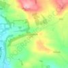
Keithhall topographic maps

Click on a map to view its topography, its elevation and its terrain.

Keithhall

United Kingdom > Scotland > Keithhall

Average elevation: 106 m

Gear up for your next adventure:

🛰️Satellite Messenger - Emergency communication for areas with no cell service
🧭Orienteering Kit - Tools for map reading and navigation in the wild
🎒Backpack Rain Cover - External shield to keep your entire pack dry
🥾All-Terrain Hiking Boots - Versatile boots for varied hiking conditions
🎒Hiking Backpack - Lightweight and ergonomic backpacks for day hikes or multi-day treks

As an Amazon Associate, this site earns from qualifying purchases at no extra cost to you.