Geolocate

Paser topographic maps

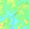
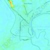
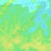
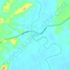
Click on a map to view its topography, its elevation and its terrain.

Tajur

Indonesia > East Kalimantan > Paser

Average elevation: 13 m

Kerta Bumi

Indonesia > East Kalimantan > Paser

Average elevation: 51 m

Gunung Melihat

Indonesia > East Kalimantan > Paser

Average elevation: 181 m

Lombok

Indonesia > East Kalimantan > Paser

Average elevation: 20 m

Long Ikis

Indonesia > East Kalimantan > Paser

Average elevation: 21 m

Tanah Grogot

Indonesia > East Kalimantan > Paser

Average elevation: 5 m

Krayan Makmur

Indonesia > East Kalimantan > Paser

Average elevation: 15 m

Random

Indonesia > East Kalimantan > Paser

Average elevation: 11 m

Sungai Kendilo

Indonesia > East Kalimantan > Paser > Pepara

Average elevation: 5 m

Jone

Indonesia > East Kalimantan > Paser

Average elevation: 15 m

Long Kali

Indonesia > East Kalimantan > Paser

Average elevation: 12 m

Laburan Baru

Indonesia > East Kalimantan > Paser

Average elevation: 8 m

Tanah Grogot

Indonesia > East Kalimantan > Paser

Average elevation: 6 m

About this place

Gear up for your next adventure:

🥾Durable Hiking Shoes - Long-lasting shoes for frequent hiking
🥾Trail Running Shoes - Lightweight and durable shoes for trail running
⛺Lightweight Camping Tent - Portable shelter optimized for Canadian backcountry camping
🔨Vehicle Emergency Tool - Safety tool for remote road trips to trailheads
🩹Compact First Aid Kit - Pre-packed essentials for common trail injuries

As an Amazon Associate, this site earns from qualifying purchases at no extra cost to you.