Geolocate

Random topographic map

Click on the map to display elevation.

About this map

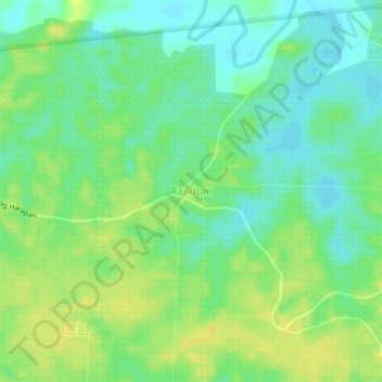
Name: Random topographic map, elevation, terrain.

Location: Random, Paser, East Kalimantan, Kalimantan, Indonesia (-2.37507 116.50443 -2.33507 116.54443)

Average elevation: 11 m

Minimum elevation: -1 m

Maximum elevation: 21 m

Other topographic maps

Click on a map to view its topography, its elevation and its terrain.

Sungai Kendilo

Indonesia > East Kalimantan > Paser > Pepara

Average elevation: 5 m

Gear up for your next adventure:

🪜Heavy Duty Carabiners - Multi-use clips for securing gear to your backpack
🥾Approach Shoes - Shoes designed for climbing approaches and rugged trails
🎒Hiking Daypack - Lightweight and durable backpacks for day trips and excursions
🧢Outdoor Visor - Breathable visor for sunny hikes
🧦Thermal Socks - Warm socks for winter hiking or camping

As an Amazon Associate, this site earns from qualifying purchases at no extra cost to you.