Geolocate

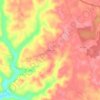
Clinton County topographic maps

Click on a map to view its topography, its elevation and its terrain.

Highway

United States > Kentucky > Clinton County

Average elevation: 287 m

Gear up for your next adventure:

🧤Insulated Winter Gloves - Heavy-duty protection for sub-zero Canadian adventures
💡LED Camping Lantern - Illuminate your campsite with long-lasting lanterns
🔭Compact Binoculars - Lightweight optics for scouting trails and wildlife
🔪Outdoor Multitool - Versatile tool for repairs and food prep in the wild
🕶️Polarized Sunglasses - Reduces glare from snow and water at high elevations

As an Amazon Associate, this site earns from qualifying purchases at no extra cost to you.