Geolocate

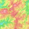
Remscheid topographic maps

Click on a map to view its topography, its elevation and its terrain.

Lennep

Duitsland > Noordrijn-Westfalen > Remscheid

Average elevation: 302 m

Gear up for your next adventure:

🧭Orienteering Kit - Tools for map reading and navigation in the wild
🔥Emergency Fire Starter - Reliable ignition source for all weather conditions
🥫Freeze-Dried Meals - Lightweight, high-calorie nutrition for multi-day treks
🦶Hiking Shoe Insoles - Added support for high arches and long days on feet
🐕Hiking Dog Pack - Let your canine companion carry their own water and food

As an Amazon Associate, this site earns from qualifying purchases at no extra cost to you.