Geolocate

Lennep topographic map

Click on the map to display elevation.

About this map
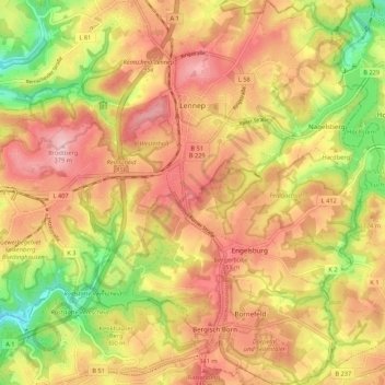
Name: Lennep topographic map, elevation, terrain.

Location: Lennep, Remscheid, North Rhine-Westphalia, 42897, Germany (51.14385 7.22607 51.21090 7.30932)

Average elevation: 302 m

Minimum elevation: 193 m

Maximum elevation: 381 m

Gear up for your next adventure:

🛰️Satellite Messenger - Emergency communication for areas with no cell service
🔨Vehicle Emergency Tool - Safety tool for remote road trips to trailheads
🕯️Camping Lantern - Illuminates your entire campsite with high-efficiency LEDs
⛺Lightweight Backpacking Tent - Compact tent for efficient hiking trips
🧼Biodegradable Camp Soap - Environmentally friendly cleaning for gear and body

As an Amazon Associate, this site earns from qualifying purchases at no extra cost to you.