Geolocate

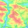
Saltash topographic maps

Click on a map to view its topography, its elevation and its terrain.

Forder

United Kingdom > England > Cornwall > Saltash

Average elevation: 39 m

Wearde Quay

United Kingdom > England > Cornwall > Saltash > Forder

Average elevation: 24 m

Latchbrook

United Kingdom > England > Cornwall > Saltash > Forder

Average elevation: 50 m

Trematon

United Kingdom > England > Cornwall > Saltash

Average elevation: 56 m

About this place

Gear up for your next adventure:

🧥Waterproof Hiking Jacket - Protect yourself from rain and wind while hiking
🧢Outdoor Cap - Protective cap for sun and rain during hikes
🗺️Topographic Maps - Detailed maps to explore trails, mountains, and wilderness areas
🥾Light Hiking Boots - Lightweight and comfortable boots for day hikes
🧥Thermal Layer - Insulating layer for cold outdoor conditions

As an Amazon Associate, this site earns from qualifying purchases at no extra cost to you.