Geolocate

Forder topographic map

Click on the map to display elevation.

About this map

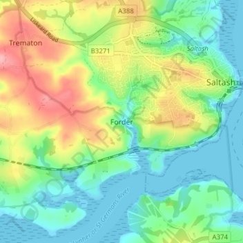
Name: Forder topographic map, elevation, terrain.

Location: Forder, Saltash, Cornwall, England, PL12 4QR, United Kingdom (50.38213 -4.25689 50.42213 -4.21689)

Average elevation: 39 m

Minimum elevation: -2 m

Maximum elevation: 110 m

Gear up for your next adventure:

🦟Insect Repellent - Keep mosquitoes and black flies away in wooded areas
🧶550 Survival Paracord - Versatile utility cord for emergency repairs and rigging
🧢Beanie Hat - Keep your head warm in cold weather
🔨Vehicle Emergency Tool - Safety tool for remote road trips to trailheads
🥾Lightweight Hiking Shoes - Comfortable shoes for day hikes

As an Amazon Associate, this site earns from qualifying purchases at no extra cost to you.