Geolocate

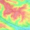
Potten End topographic maps

Click on a map to view its topography, its elevation and its terrain.

Gear up for your next adventure:

🗺️Topographic Maps - Detailed maps to explore trails, mountains, and wilderness areas
🛰️Satellite Messenger - Emergency communication for areas with no cell service
🧦Hiking Liner Socks - Thin base layer to prevent friction and blisters
🥾Durable Hiking Shoes - Long-lasting shoes for frequent hiking
🔪Outdoor Multitool - Versatile tool for repairs and food prep in the wild

As an Amazon Associate, this site earns from qualifying purchases at no extra cost to you.