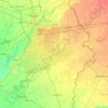
Punjab topographic maps
Click on a map to view its topography, its elevation and its terrain.


Kot Addu
Pakistan > Punjab > Kot Addu District
The city of Kot Addu is located in the southern area of Punjab province, almost at the exact center of Pakistan. The area around the city is a flat plain and is ideal for agriculture. There are two main canals (Muzaffar, and T.P. link) and eight sub-canals that cross Kot Addu, providing water from the Indus…
Average elevation: 134 m


Faisalabad
The soil consists of young stratified silt loam or very fine sand loam which makes the subsoil weak in structure with common kankers at only five feet. The course of the rivers within Faisalabad are winding and often subject to frequent alternations. In the rainy season, the currents are very strong. This…
Average elevation: 184 m


Gujranwala
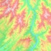
Gujranwala sits at the heart of the Rechna Doab, a strip of land between the Chenab in the north, and Ravi River in the south. Gujranwala is also part of the Majha, a historical region of northern Punjab. The city was built upon the plains of Punjab, and the surrounding region is an unbroken plain devoid of…
Average elevation: 225 m

Lakhan Qasbati
Pakistan > Punjab > Rawalpindi District > Rawalpindi Cantonment
Average elevation: 512 m



New Awan Town
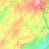
Pakistan > Punjab > Rawalpindi District > Rawalpindi Cantonment
Average elevation: 530 m


Pakpattan District
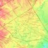
Malka Hans is the ancient famous town near Pakpattan in Pakpattan District located between Pakpattan and Sahiwal on Sahiwal Road. Malka Hans is located at 30°25′26.4″N 73°16′33.6″E / 30.424000°N 73.276000°E / 30.424000; 73.276000 at an altitude of 150 metres (490 ft).
Average elevation: 162 m


Bahawalnagar
In 1904 when Nawab Mohammad Bahawal Khan Abbasi IV, who originally ruled over Bahawalpur State visited Rojhanwali the people asked that with His permission they want to rename the city on the name of Nawab, The Nawab allowed them with pleasure and since then the city is named as Bahawalnagar. With the advent…
Average elevation: 158 m


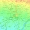


Gujranwala City Tehsil
Gujranwala sits at the heart of the Rechna Doab, a strip of land between the Chenab in the north, and Ravi River in the south. Gujranwala is also part of the Majha, a historical region of northern Punjab. The city was built upon the plains of Punjab, and the surrounding region is an unbroken plain devoid of…
Average elevation: 225 m