Geolocate

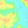
Selmer topographic map

Click on the map to display elevation.

About this map

Name: Selmer topographic map, elevation, terrain.

Location: Selmer, McNairy County, West Tennessee, Tennessee, 38375, United States (35.13215 -88.63026 35.21019 -88.54773)

Average elevation: 152 m

Minimum elevation: 123 m

Maximum elevation: 187 m

Other topographic maps

Click on a map to view its topography, its elevation and its terrain.
Mount Vinson

United States > Tennessee > McNairy County

Average elevation: 131 m

Gear up for your next adventure:

🧴Outdoor Sunscreen - High SPF protection for high-altitude UV exposure
🧢Sun Hat - Wide-brim hat for sun protection
🥾Approach Shoes - Shoes designed for climbing approaches and rugged trails
🛌Insulated Sleeping Pad - Critical thermal barrier between you and the cold ground
⛺Lightweight Camping Tent - Portable shelter optimized for Canadian backcountry camping

As an Amazon Associate, this site earns from qualifying purchases at no extra cost to you.