Geolocate

Tinta topographic maps

Click on a map to view its topography, its elevation and its terrain.
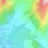
Sullia

Peru > Cusco > Tinta > Machacmarca

Average elevation: 3,693 m

About this place

Gear up for your next adventure:

🥾Approach Shoes - Shoes designed for climbing approaches and rugged trails
🧰Emergency Multi-Tool - Compact multi-tool for outdoor survival
🦯Trekking Poles - Reduced impact on joints for steep topographic climbs
🧥Thermal Fleece Jacket - Versatile insulation for changing mountain temperatures
🥾Waterproof Hiking Shoes - Durable shoes for wet and rugged trails

As an Amazon Associate, this site earns from qualifying purchases at no extra cost to you.