Peru topographic maps
Click on a map to view its topography, its elevation and its terrain.



Pisac
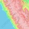
The town is located in the district of Pisac, in the province of Calca, at the southern end of the Sacred Valley at an altitude of 2,972 metres (9,751 ft), 32 kilometres (20 mi) northeast of Cusco. The town straddles the Vilcanota River, with most of the settlement on its right bank, where it is laid out in a…
Average elevation: 3,520 m


Sacred Valley of the Incas
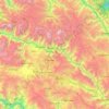
The valley, running generally west to east, is understood to include everything along the Urubamba River between the town and Inca ruins at Písac and Machu Picchu, 100 kilometres (62 mi) distant. The Sacred Valley has elevations above sea level along the river ranging from 3,000 metres (9,800 ft) at Pisac to…
Average elevation: 3,808 m
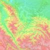
Province of La Convención
As part of the higher-altitude Amazon basin at the foot of the Andes, La Convención is one of three Peruvian provinces that prominently figure in national coffee production, the other being Chanchamayo province in Junín and Jaén province in Cajamarca.
Average elevation: 1,804 m
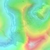
Machu Picchu
Peru > Cusco > Machupicchu > San Miguel
Animals are also suspected to have immigrated to Machu Picchu as there were several bones found that were not native to the area. Most animal bones found were from llamas and alpacas. These animals naturally live at altitudes of 4,000 metres (13,000 ft) rather than the 2,400 metres (7,900 ft) elevation of…
Average elevation: 2,227 m
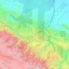
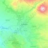

Colca Canyon
Peru > Arequipa > Cabanaconde
In May 1981, the Polish Canoandes rafting expedition, led by Andrzej Pietowski, made the first descent of the river below Cabanaconde and proclaimed the possibility of its being the world's deepest canyon. It was so recognized by the Guinness Book of Records in 1984, and a National Geographic article in…
Average elevation: 3,169 m


Huancayo
Huancayo (Spanish pronunciation: [waŋˈkaʝo]; in Wanka Quechua: Wankayu, '(place) with a (sacred) rock', Quechua pronunciation: [waŋˈkajuː]) is the capital of the Junín Region and Huancayo Province, in the central highlands of Peru, in the Mantaro Valley and is crossed by the Shullcas, Chilca and Mantaro…
Average elevation: 3,818 m
La Bella Durmiente
La Bella Durmiente (Spanish for Sleeping Beauty), also known as Puma Ringri (possibly from Quechua puma cougar, puma, rinri ear, "puma ear"), is a mountain and prominent feature of Tingo María National Park, in the region of Huánuco, Peru. It is located in the district of Mariano Damaso, Leoncio Prado…
Average elevation: 877 m







Abancay
Abancay is located at an elevation of 2,377 metres (7,799 ft) above sea level in the southern Peruvian Andes, above the Pachachaca River, and straddles the Marino River. Because of its dry mountain and famous year-round warm weather it is known as "The Eternal Springtime Valley". The nearest cities are Cusco,…
Average elevation: 3,400 m

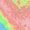

Trujillo
Trujillo is located at an altitude of 34 metres (112 feet) on a coastal strip in the west of the province of Trujillo, in the old valley of Chimor today known as the Moche or Santa Catalina Valley. Its main square is located at 8°6′3″S 79°1′34″W / 8.10083°S 79.02611°W / -8.10083; -79.02611…
Average elevation: 213 m
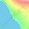

Huaraz
Huaraz ([waˈɾas]) (from Quechua: Waraq or Warash, "dawn"), formerly designated as San Sebastián de Huaraz, is a city in Peru. It is the capital of the Ancash Region (State of Ancash) and the seat of government of Huaraz Province. The urban area's population is distributed over the districts of Huaraz and…
Average elevation: 4,068 m


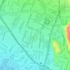


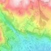
Sacsayhuamán
Peru > Cusco > Cuzco > Mollococha
Sacsayhuamán (/ˈsæksaɪˌwʌmən/ SACK-sy-wuh-mən; Spanish pronunciation: [saksajwaˈman]) or Saksaywaman (from Quechua Saksay waman pukara, pronounced [ˈsaksaj ˈwaman], lit. 'fortress of the royal falcon or hawk') is a citadel on the northern outskirts of the city of Cusco, Peru, the historic capital…
Average elevation: 3,578 m




Manu National Park
Manu National Park covers an area of 1,716,295.22 hectares (17,162.95 km2) which comprises mountainous areas (traversed by creeks and valleys) with elevations close to 4000 m above sea level and a portion of the Amazon Basin plains.
Average elevation: 1,010 m


Amazonas
The Amazonian Andes are constituted by the oriental flank of the Andes, covered originally by a dense Amazon vegetation. It spread from the cordillera spurs until reaching surprising altitudes where the forests have not been felled, in certain cases exceeding the 3 500 m.
Average elevation: 1,119 m


Cordillera Huayhuash
The area preserves high elevation Andean grasslands and patches of forest. Some of the native tree species present in the area are the Andean alder and trees of the genus Polylepis.
Average elevation: 4,826 m

Cajamarca
Cajamarca (Spanish pronunciation: [kaxaˈmaɾka]; Quechua: Kashamarka; Aymara: Qajamarka) is a department and region in Peru. The capital is the city of Cajamarca. It is located in the north part of the country and shares a border with Ecuador. The city has an elevation of 2,700 metres (8,900 ft) above sea…
Average elevation: 1,456 m

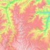
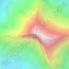
Nevado Salkantay
Salcantay, Salkantay or Sallqantay (in Quechua) is the highest peak in the Vilcabamba mountain range, part of the Peruvian Andes. It is located in the Cusco Region, about 60 km (40 mi) west-northwest of the city of Cusco. It is the 38th-highest peak in the Andes and the twelfth-highest in Peru. However, as a…
Average elevation: 5,266 m


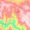
Chinchaypujio
The district of Chinchaypujio has a 2,000-metre (6,600 ft) altitude spread from south to north; hence, the district is home to multiple climate zones. In the south, the Apurímac River runs at 2,200-metre (7,200 ft) elevation where Banana Isla Maleño and other tropical fruit can be grown, in the north, the…
Average elevation: 3,604 m
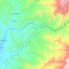




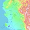
Piura
Topography is smooth in the coast and rough in the Sierra. There are many arid plains in the southern region. The Sechura Desert, located south of the Piura River, is Peru's largest desert and one of the world's few examples of a tropical desert; it borders a tropical terrain to the north. The Bayóvar…
Average elevation: 675 m