Geolocate

Westmorland County topographic maps

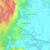
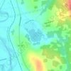
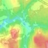
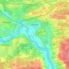
Click on a map to view its topography, its elevation and its terrain.

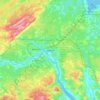
Dieppe

Canada > New Brunswick > Westmorland County > Dieppe

Average elevation: 58 m

Memramcook

Canada > New Brunswick > Westmorland County

Average elevation: 59 m

Cap-Pelé

Canada > New Brunswick > Westmorland County

Average elevation: 13 m

Town of Shediac

Canada > New Brunswick > Westmorland County

Its topography is relatively flat and its soil is mostly composed of sedimentary rocks dating from the Pennsylvanian. Shediac enjoys a continental climate.

Average elevation: 28 m
Memramcook

Canada > New Brunswick > Westmorland County

Average elevation: 57 m

About this place

 •  •  •  •  •  •  •  •

Gear up for your next adventure:

🧥Ultralight Puffy Jacket - Maximum warmth that packs down to the size of an orange
🔦LED Headtorch - Bright and durable light for night activities
🗺️Topographic Maps - Detailed maps to explore trails, mountains, and wilderness areas
🔭Compact Binoculars - Lightweight optics for scouting trails and wildlife
🌬️Windproof Camp Stove - Efficient cooking even on exposed mountain peaks

As an Amazon Associate, this site earns from qualifying purchases at no extra cost to you.