Geolocate

New Scotland topographic map

Click on the map to display elevation.

About this map

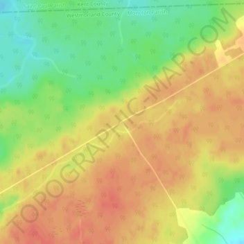
Name: New Scotland topographic map, elevation, terrain.

Location: New Scotland, Moncton Parish, Westmorland County, New Brunswick, Canada (46.24693 -64.91252 46.26693 -64.89252)

Average elevation: 85 m

Minimum elevation: 56 m

Maximum elevation: 104 m

Westmorland County trails, hiking, mountain biking, running and outdoor activities

Other topographic maps

Click on a map to view its topography, its elevation and its terrain.

Memramcook

Canada > New Brunswick > Westmorland County

Average elevation: 59 m

Cap-Pelé

Canada > New Brunswick > Westmorland County

Average elevation: 13 m

Memramcook

Canada > New Brunswick > Westmorland County

Average elevation: 57 m

Town of Shediac

Canada > New Brunswick > Westmorland County

Its topography is relatively flat and its soil is mostly composed of sedimentary rocks dating from the Pennsylvanian. Shediac enjoys a continental climate.

Average elevation: 28 m

Shediac

Canada > New Brunswick > Westmorland County

Average elevation: 17 m

Gear up for your next adventure:

🧥Ultralight Puffy Jacket - Maximum warmth that packs down to the size of an orange
🗺️Topographic Maps - Detailed maps to explore trails, mountains, and wilderness areas
💧Hydration Pack - Hands-free hydration system for long hikes
🔋Solar Power Bank - Keep your GPS and devices charged during long outdoor trips
🔪Outdoor Multitool - Versatile tool for repairs and food prep in the wild

As an Amazon Associate, this site earns from qualifying purchases at no extra cost to you.