Geolocate

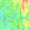
Maen-Roch topographic maps

Click on a map to view its topography, its elevation and its terrain.

La Bassetais

France > Bretagne > Ille-et-Vilaine > Maen-Roch

Average elevation: 120 m

Les Houx

France > Bretagne > Ille-et-Vilaine > Maen-Roch

Average elevation: 108 m

Le Pont

France > Bretagne > Ille-et-Vilaine > Maen-Roch

Average elevation: 109 m

La Barrière

France > Bretagne > Ille-et-Vilaine > Maen-Roch

Average elevation: 108 m

La Houasserie

France > Bretagne > Ille-et-Vilaine > Maen-Roch

Average elevation: 108 m

Le Pont

France > Bretagne > Ille-et-Vilaine > Maen-Roch

Average elevation: 119 m

About this place

Gear up for your next adventure:

👟Sport Hiking Sandals - Breathable footwear for water crossings and camp rest
🧦Crew Hiking Socks - Comfortable socks for long-distance hikes
🛏️Sleeping Bag - Warm and compact sleeping bags for outdoor camping
🥾Light Trekking Boots - Supportive boots for multi-day treks
🧭GPS Outdoor Watch - Smart watch for navigation and fitness tracking in nature

As an Amazon Associate, this site earns from qualifying purchases at no extra cost to you.