Geolocate

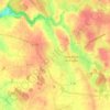
Le Pont topographic map

Click on the map to display elevation.

About this map

Name: Le Pont topographic map, elevation, terrain.

Location: Le Pont, Saint-Brice-en-Coglès, Maen-Roch, Fougères-Vitré, Ille-et-Vilaine, Bretagne, France métropolitaine, 35460, France (48.39603 -1.38146 48.43603 -1.34146)

Average elevation: 109 m

Minimum elevation: 81 m

Maximum elevation: 128 m

Other topographic maps

Click on a map to view its topography, its elevation and its terrain.
Gear up for your next adventure:

🥾Hiking Leggings - Comfortable leggings for outdoor activities
🥾Waterproof Hiking Shoes - Durable shoes for wet and rugged trails
🥾Trekking Boots - Durable boots for long-distance trekking
🔥Camping Stove - Portable stoves to cook outdoors with ease
🧢Outdoor Visor - Breathable visor for sunny hikes

As an Amazon Associate, this site earns from qualifying purchases at no extra cost to you.