Geolocate

Le Pont topographic map

Click on the map to display elevation.

About this map
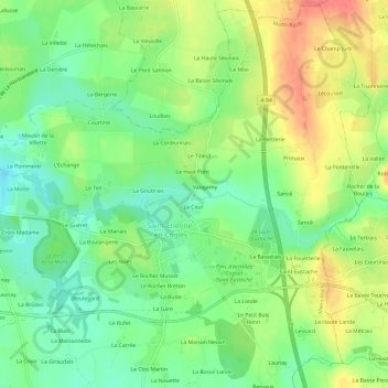
Name: Le Pont topographic map, elevation, terrain.

Location: Le Pont, Saint-Étienne-en-Coglès, Maen-Roch, Fougères-Vitré, Ille-et-Vilaine, Bretagne, France métropolitaine, 35460, France (48.38697 -1.34321 48.42697 -1.30321)

Average elevation: 119 m

Minimum elevation: 91 m

Maximum elevation: 155 m

Other topographic maps

Click on a map to view its topography, its elevation and its terrain.

Gear up for your next adventure:

⛺Backpacking Tent - Lightweight tent for long-distance hiking trips
👖Convertible Hiking Pants - Zip-off legs to adapt to changing weather conditions
🥾Waterproof Hiking Boots - Boots keeping your feet dry in wet conditions
🕶️Polarized Sunglasses - Reduces glare from snow and water at high elevations
🧦Thermal Socks - Warm socks for winter hiking or camping

As an Amazon Associate, this site earns from qualifying purchases at no extra cost to you.