Geolocate

Pauri topographic maps

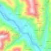
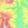
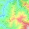
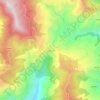
Click on a map to view its topography, its elevation and its terrain.

Pauri

India > Uttarakhand > Pauri

Average elevation: 1,423 m

Pabau

India > Uttarakhand > Pauri

Average elevation: 1,270 m

Bilkhet

India > Uttarakhand > Pauri > Bānghāt

Average elevation: 799 m

Hitoli

India > Uttarakhand > Pauri

Average elevation: 1,384 m

dalmota

India > Uttarakhand > Pauri

Average elevation: 1,494 m

kaldhung

India > Uttarakhand > Pauri > Pauri

Average elevation: 1,283 m

bairagarh

India > Uttarakhand > Pauri > Pauri > bairagarh

Average elevation: 1,337 m

thaplialgaon

India > Uttarakhand > Pauri > Pauri

Average elevation: 1,634 m

pang

India > Uttarakhand > Pauri

Average elevation: 1,272 m

Kaljikhal

India > Uttarakhand > Pauri

Average elevation: 1,657 m

About this place

 •

Gear up for your next adventure:

🛌Down Sleeping Bag - Superior warmth-to-weight ratio for cold nights
🥾Hiking Leggings - Comfortable leggings for outdoor activities
🦶Hiking Shoe Insoles - Added support for high arches and long days on feet
🧥Waterproof Hiking Jacket - Protect yourself from rain and wind while hiking
🥾Waterproof Hiking Boots - Boots keeping your feet dry in wet conditions

As an Amazon Associate, this site earns from qualifying purchases at no extra cost to you.