Geolocate

Yuracmarca topographic maps

Click on a map to view its topography, its elevation and its terrain.

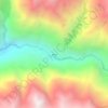
Champará

Perú > Áncash > Yuracmarca

Champara o Champará es una montaña en el norte de la Cordillera Blanca en los Andes del Perú y tiene una elevación de 5.735 metros. Se encuentra ubicado en el distrito de Yuracmarca, provincia de Huaylas, dentro de la región de Ancash. Champara se encuentra al sureste del lago Quyllurqucha.

Average elevation: 5,027 m
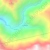
Quitaracsa

Perú > Áncash > Yuracmarca

Average elevation: 3,831 m

Secsi

Perú > Áncash > Yuracmarca

Average elevation: 3,679 m

Gear up for your next adventure:

🧥Thermal Fleece Jacket - Versatile insulation for changing mountain temperatures
🧥Fleece Jacket - Warm and lightweight jacket for layering
🧦Outdoor Socks - Durable socks designed for hiking and outdoor sports
Tent Footprint - Protect tent floor and increase durability
👟Trail Running Shoes - Agile footwear for fast-paced topographic exploration

As an Amazon Associate, this site earns from qualifying purchases at no extra cost to you.