Click on a map to view its topography, its elevation and its terrain.
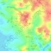
France > Nouvelle-Aquitaine > Charente-Maritime > Arces
Average elevation: 26 m
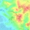
France > Nouvelle-Aquitaine > Charente-Maritime > Arces > Le Breuil
Average elevation: 29 m
Average elevation: 25 m
Average elevation: 21 m
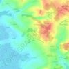
France > Nouvelle-Aquitaine > Charente-Maritime > Arces > Le Grand Theuillac
Average elevation: 20 m
Average elevation: 32 m
As an Amazon Associate, this site earns from qualifying purchases at no extra cost to you.