Geolocate

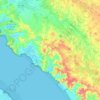
Chapitre topographic map

Click on the map to display elevation.

About this map

Name: Chapitre topographic map, elevation, terrain.

Location: Chapitre, Arces, Saintes, Charente-Maritime, Nouvelle-Aquitaine, France métropolitaine, 17120, France (45.55494 -0.88651 45.59494 -0.84651)

Average elevation: 32 m

Minimum elevation: -1 m

Maximum elevation: 55 m

Other topographic maps

Click on a map to view its topography, its elevation and its terrain.
Gear up for your next adventure:

🧥Softshell Jacket - Windproof and breathable jacket for hiking
🦶Anti-Blister Balm - Prevents friction and hotspots during long ascents
🧊Portable Cooler - Keep food and drinks cold during outdoor adventures
🥤Collapsible Travel Cup - Saves space and weight in your mess kit
🔋Emergency Crank Radio - Weather alerts and power without needing batteries

As an Amazon Associate, this site earns from qualifying purchases at no extra cost to you.