Geolocate

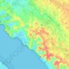
Lorivaux topographic map

Click on the map to display elevation.

About this map

Name: Lorivaux topographic map, elevation, terrain.

Location: Lorivaux, Arces, Saintes, Charente-Maritime, Nouvelle-Aquitaine, France métropolitaine, 17120, France (45.52394 -0.86349 45.56394 -0.82349)

Average elevation: 26 m

Minimum elevation: -1 m

Maximum elevation: 54 m

Other topographic maps

Click on a map to view its topography, its elevation and its terrain.
Gear up for your next adventure:

❄️Traction Ice Cleats - Slip-on spikes for icy trails and winter hiking
🐕Hiking Dog Pack - Let your canine companion carry their own water and food
🧥Softshell Jacket - Windproof and breathable jacket for hiking
☕Camping Coffee Maker - Brew fresh coffee anywhere on the topographic map
🩹Compact First Aid Kit - Pre-packed essentials for common trail injuries

As an Amazon Associate, this site earns from qualifying purchases at no extra cost to you.