Geolocate

Kingsville topographic map

Click on the map to display elevation.

About this map

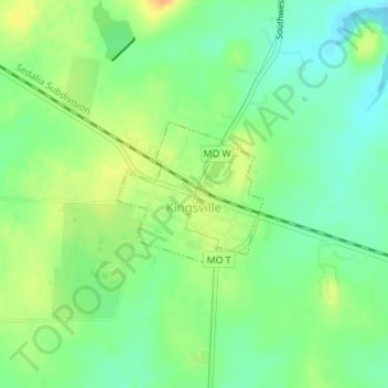
Name: Kingsville topographic map, elevation, terrain.

Location: Kingsville, Johnson County, Missouri, United States (38.73898 -94.07681 38.74898 -94.06371)

Average elevation: 272 m

Minimum elevation: 256 m

Maximum elevation: 293 m

Other topographic maps

Click on a map to view its topography, its elevation and its terrain.

Fulkerson

United States > Missouri > Johnson County

Average elevation: 298 m

Pittsville

United States > Missouri > Johnson County

Average elevation: 270 m

Gear up for your next adventure:

🧦Hiking Liner Socks - Thin base layer to prevent friction and blisters
🧥Packable Rain Jacket - Breathable waterproof layer for unpredictable weather
🧥Insulated Jacket - Keep warm in cold outdoor conditions
💧Hydration Bladder - Hands-free hydration solution for long treks
🥾Light Trekking Boots - Supportive boots for multi-day treks

As an Amazon Associate, this site earns from qualifying purchases at no extra cost to you.