Geolocate

Clayton topographic map

Click on the map to display elevation.

About this map
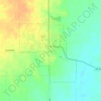
Name: Clayton topographic map, elevation, terrain.

Location: Clayton, Hendricks County, Indiana, United States (39.67954 -86.53343 39.69646 -86.51344)

Average elevation: 263 m

Minimum elevation: 247 m

Maximum elevation: 281 m

Other topographic maps

Click on a map to view its topography, its elevation and its terrain.

Gear up for your next adventure:

🦶Hiking Shoe Insoles - Added support for high arches and long days on feet
🐕Hiking Dog Pack - Let your canine companion carry their own water and food
🧼Biodegradable Camp Soap - Environmentally friendly cleaning for gear and body
🔭Outdoor Binoculars - Lightweight binoculars for birdwatching and hiking
🔪Outdoor Multitool - Versatile tool for repairs and food prep in the wild

As an Amazon Associate, this site earns from qualifying purchases at no extra cost to you.