Geolocate

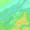
Iquitos topographic map

Click on the map to display elevation.

About this map
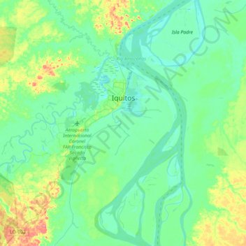
Name: Iquitos topographic map, elevation, terrain.

Location: Iquitos, Province of Maynas, Loreto, Peru (-3.88645 -73.59096 -3.68525 -73.23643)

Average elevation: 94 m

Minimum elevation: 78 m

Maximum elevation: 146 m

Other topographic maps

Click on a map to view its topography, its elevation and its terrain.

Iquitos

Peru > Loreto

Average elevation: 92 m

Manchuria

Peru > Loreto > Manchuria

Average elevation: 125 m

Centro America

Peru > Loreto > Balas Puerto

Average elevation: 155 m

Francisco de Orellana

Peru > Loreto > Las Amazonas

Average elevation: 81 m

Güeppi

Peru > Loreto > Teniente Manuel Clavero

Average elevation: 197 m

Isla Iquitos

Peru > Loreto > Belén

Average elevation: 86 m

San Alejandro

Peru > Loreto > Mazán

Average elevation: 85 m

Pucalpillo

Peru > Loreto > Balas Puerto

Average elevation: 191 m

Isla Iquitos

Peru > Loreto > Belén

Average elevation: 86 m

Santa Fe

Peru > Loreto > Emilio San Martín

Average elevation: 103 m

Naciente del Amazonas

Peru > Loreto > Nauta

Average elevation: 99 m

Antioquia

Peru > Loreto

Average elevation: 205 m

Centro America

Peru > Loreto > Balas Puerto

Average elevation: 155 m

Cuchara

Peru > Loreto > Trompeteros

Average elevation: 126 m

San Rogue

Peru > Loreto

Average elevation: 104 m

Gear up for your next adventure:

🐕Hiking Dog Pack - Let your canine companion carry their own water and food
🥾Approach Boots - Comfortable boots for hiking and climbing approaches
👖Convertible Hiking Pants - Zip-off legs to adapt to changing weather conditions
🧦Outdoor Socks - Durable socks designed for hiking and outdoor sports
🧥Insulated Jacket - Keep warm in cold outdoor conditions

As an Amazon Associate, this site earns from qualifying purchases at no extra cost to you.