Geolocate

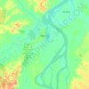
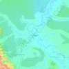
Iquitos topographic map

Click on the map to display elevation.

About this map

Name: Iquitos topographic map, elevation, terrain.

Location: Iquitos, Province of Maynas, Loreto, 16002, Peru (-3.90937 -73.40441 -3.58937 -73.08441)

Average elevation: 92 m

Minimum elevation: 78 m

Maximum elevation: 139 m

Other topographic maps

Click on a map to view its topography, its elevation and its terrain.
Iquitos

Peru > Loreto

Average elevation: 94 m

Nauta

Peru > Loreto

Average elevation: 116 m

Pebas

Peru > Loreto

Average elevation: 106 m

Contamana

Peru > Loreto

Average elevation: 220 m

Yurimaguas

Peru > Loreto

Average elevation: 177 m

Requena

Peru > Loreto

Average elevation: 116 m

Iquitos

Peru > Loreto

Average elevation: 94 m

Iquitos

Peru > Loreto

Average elevation: 94 m

Province of Requena

Peru > Loreto

Average elevation: 157 m

Yurimaguas

Peru > Loreto

Average elevation: 177 m

Morona

Peru > Loreto

Average elevation: 367 m

Gear up for your next adventure:

🛏️Sleeping Bag - Warm and compact sleeping bags for outdoor camping
🧥Thermal Fleece Jacket - Versatile insulation for changing mountain temperatures
⛺Backpacking Tent - Lightweight tent for long-distance hiking trips
🚑Survival Whistle - Signal for help across long distances in mountains
🦌Outdoor Trail Camera - Monitor wildlife activity near your favorite spots

As an Amazon Associate, this site earns from qualifying purchases at no extra cost to you.