
Rockwell topographic map
Click on the map to display elevation.
About this map
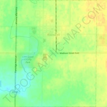
Name: Rockwell topographic map, elevation, terrain.
Location: Rockwell, Cerro Gordo County, Iowa, United States (42.96559 -93.20233 42.99441 -93.17214)
Average elevation: 343 m
Minimum elevation: 328 m
Maximum elevation: 353 m
Other topographic maps
Click on a map to view its topography, its elevation and its terrain.
Clear Lake
United States > Iowa > Cerro Gordo County > Clear Lake > Clear Lake
Average elevation: 373 m