
Hungry Valley topographic map
Click on the map to display elevation.
About this map
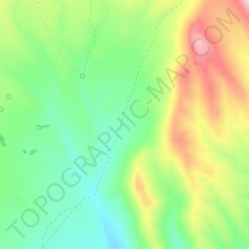
Name: Hungry Valley topographic map, elevation, terrain.
Location: Hungry Valley, Mohave County, Arizona, United States (36.55965 -114.00166 36.57424 -113.99367)
Average elevation: 1,177 m
Minimum elevation: 1,097 m
Maximum elevation: 1,293 m
Other topographic maps
Click on a map to view its topography, its elevation and its terrain.
Bullhead City
United States > Arizona > Mohave County
Hardyville Pioneer Cemetery, a small cemetery, now a historic landmark at 35°7′16″N 114°35′17″W / 35.12111°N 114.58806°W / 35.12111; -114.58806, is the most significant existing remnant of Hardyville. An unofficial historical marker for the town is in the parking lot across Highway 95 from…
Average elevation: 328 m
Antares
United States > Arizona > Mohave County > Antares
Antares is located in northwestern Arizona, in central Mohave County, 21 miles (34 km) northeast of Kingman, the county seat. The Antares census-designated place encompasses 0.65 square miles (1.7 km2) of land, and is at 3,556 feet (1,084 m) elevation above sea level. The southern edge of the CDP follows State…
Average elevation: 1,060 m
Oatman
United States > Arizona > Mohave County
Oatman is a census-designated place (CDP) in the Black Mountains of Mohave County, Arizona, United States, at an elevation of 2,710 feet (830 m). In 1915, it began as a small mining camp when two prospectors struck US$10 million (equivalent to $176 million in 2024) in gold, though the vicinity had already been…
Average elevation: 894 m
Mount Trumbull Wilderness
United States > Arizona > Mohave County
At lower elevations the vegetation of the wilderness consists of Utah juniper (Juniperus osteosperma), pinyon pine, Mojave yucca (Yucca schidigera), and sagebrush (Artemisia tridentata). Moving up, the vegetation slowly changes into ponderosa pines. The area was heavily logged in the late 19th century…
Average elevation: 1,973 m
Kingman
United States > Arizona > Mohave County
Lt. Edward Fitzgerald Beale, a U.S. Navy officer in the service of the Army Corps of Topographical Engineers, was ordered by the U.S. War Department to build a federal wagon road across the 35th parallel. His secondary orders were to test the feasibility of the use of camels as pack animals in the Southwestern…
Average elevation: 1,131 m
Pigeon Point Lighthouse
United States > Arizona > Mohave County > Lake Havasu City
Average elevation: 155 m
Bullhead City
United States > Arizona > Mohave County
Hardyville Pioneer Cemetery, a small cemetery, now a historic landmark at 35°7′16″N 114°35′17″W / 35.12111°N 114.58806°W / 35.12111; -114.58806, is the most significant existing remnant of Hardyville. An unofficial historical marker for the town is in the parking lot across Highway 95 from…
Average elevation: 322 m
Bullhead City
United States > Arizona > Mohave County
Hardyville Pioneer Cemetery, a small cemetery, now a historic landmark at 35°7′16″N 114°35′17″W / 35.12111°N 114.58806°W / 35.12111; -114.58806, is the most significant existing remnant of Hardyville. An unofficial historical marker for the town is in the parking lot across Highway 95 from…
Average elevation: 328 m
Kingman
United States > Arizona > Mohave County
Lt. Edward Fitzgerald Beale, a U.S. Navy officer in the service of the Army Corps of Topographical Engineers, was ordered by the U.S. War Department to build a federal wagon road across the 35th parallel. His secondary orders were to test the feasibility of the use of camels as pack animals in the Southwestern…
Average elevation: 1,130 m